|
REFINE
Browse All : cartographic image from 1916
1-5 of 5
Name Display Form
[Clason, George S. (George Samuel), 1874-1957, Clason Map Co.]
Title
Approved mineral surveys of the principal mining districts in Boulder County, Colorado
Date Issued
1916
Name Display Form
Clason Map Co.
Title
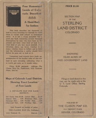
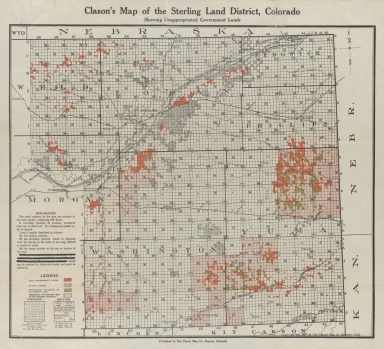
Clason's map of the Sterling Land District, Colorado
Date Issued
1916
Name Display Form
Clason Map Co.
Title
Clason's map of the Sterling Land District, Colorado
Date Issued
1916
Title
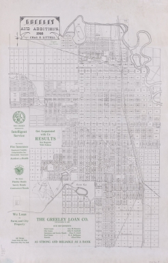
Greeley and additions
Date Issued
1916
1-5 of 5
|

![Map of Colorado River and its tributaries [Southwestern States] : showing volume of discharge](https://cudl.colorado.edu/MediaManager/srvr?mediafile=/Size2/CUB~13~13/4709/maps_coHistorical_1916_coRiverTributaries_d.jpg)