|
REFINE
Browse All : Cartographic materials and Maps
1-7 of 7
Title
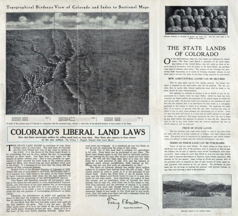
Atlas of the state lands of Colorado
Date Issued
1914
Name Display Form
Geographical Publishing Co.
Title
Colorado
Date Issued
1920/[1929]
Name Display Form
Glover, E. S. (Eli Sheldon), 1844-1920
Title
Glover's birds eye view of Denver, Colorado, 1874
Date Issued
1874
Title
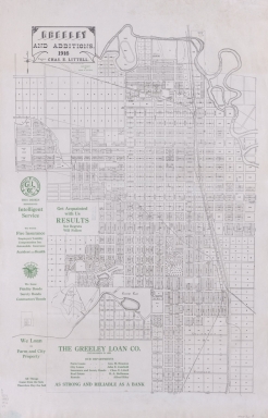
Greeley and additions
Date Issued
1916
Name Display Form
Willits, W. C. (Warren C.), 1847-1901
Title
Map of Boulder Colorado
Date Issued
1887
Name Display Form
Prather, Ralph Carlyle
Title
Prather's aerial view of the Rocky Mountain National, Estes, Park [Colorado]
Date Issued
1922
1-7 of 7
|


![Prather's aerial view of the Rocky Mountain National, Estes, Park [Colorado]](https://cudl.colorado.edu/MediaManager/srvr?mediafile=/Size3/CUB~13~13/4711/maps_coHistorical_prathersRMN1922.jpg)
