COLLECTION NAME:
Mining Maps of Colorado
Record
Collection Name:
Mining Maps of Colorado
Title:
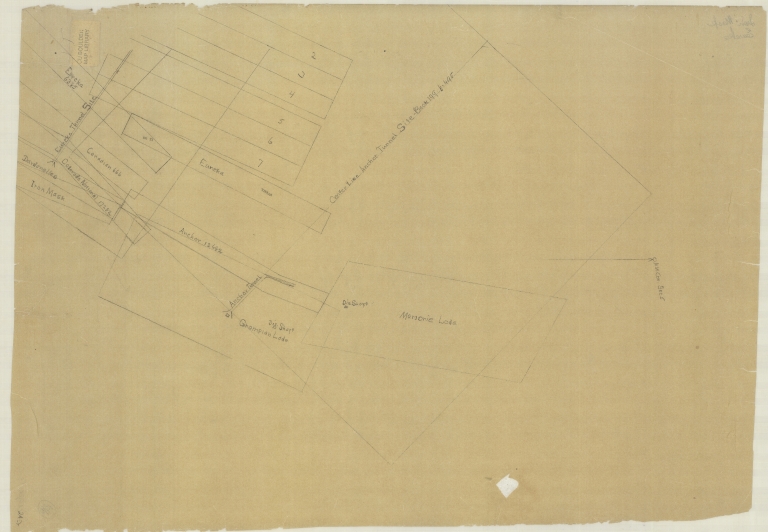
Map of Marjorie Lode mine claim
State:
Colorado
County:
Gunnison
USGS Quadrangle:
Mount Axtell
Type of Resource:
cartographic image
Genre:
Maps
Place Term:
[Place of publication not given]
Publisher:
[Publisher not identified]
Date Issued:
Undated
Language Term:
English
Form:
Cartographic materials
Internet Media Type:
image/tiff
Extent:
1 map : manuscript, pencil ; 40.5 x 63 cm
Digital Origin:
reformatted digital
Mine Note:
Marjorie Lode; Grampian Lode; Eureka; Iron Mask
Subject Topic:
Mines and mineral resources
Scale:
[Scale not given]
Coordinates:
38° 52' 15.96'' N / 107° 5' 24'' W
Public Land Survey Location:
[Public land survey not available]
Identifier:
43355900.tif
Physical Location:
Jerry Crail Johnson Earth Sciences & Map Library, University of Colorado Boulder
Rights:
The copyright and related rights status of this Item has been reviewed by the organization that has made the Item available, but the organization was unable to make a conclusive determination as to the copyright status of the Item. Please refer to the organization that has made the Item available for more information. You are free to use this Item in any way that is permitted by the copyright and related rights legislation that applies to your use.
Map of Marjorie Lode mine claim