COLLECTION NAME:
Mining Maps of Colorado
Record
Collection Name:
Mining Maps of Colorado
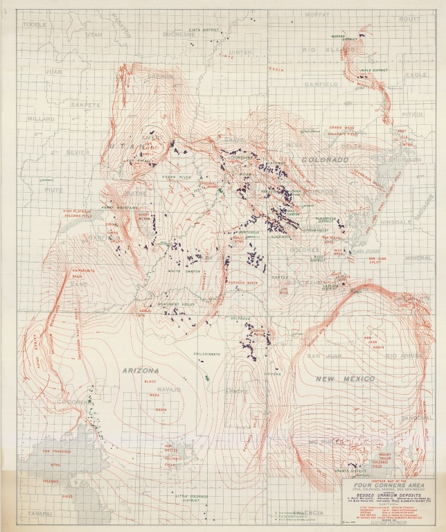
Title:
Contour map of the Four Corners area
Subtitle:
Utah, Colorado, Arizona, and New Mexico
State:
Arizona
County:
Apache
USGS Quadrangle:
Teec Nos Pos
Type of Resource:
cartographic image
Genre:
Maps
Place Term:
[Place of publication not given]
Publisher:
[Publisher not identified]
Date Issued:
1954
Date Created:
1953-12/1954-11
Language Term:
English
Form:
Cartographic materials
Internet Media Type:
image/tiff
Extent:
1 map : color ; 84.5 x 68.5 cm
Digital Origin:
reformatted digital
Mine Note:
Placerville District; Chilchinbeto (mine district); Monument Valley (mine district); Henry Mountains (mine district); Green River (mine district); Four Corners
Subject Topic:
Mines and mineral resources
Scale:
1" = 63360'
Coordinates:
36° 59' 56.04'' N / 109° 2' 43.08'' W
Meridian:
G&SR
Public Land Survey Location:
Sec.6, T.41N.R.31E
Identifier:
43353400.tif
Physical Location:
Jerry Crail Johnson Earth Sciences & Map Library, University of Colorado Boulder
Rights:
This Item is protected by copyright and/or related rights. You are free to use this Item in any way that is permitted by the copyright and related rights legislation that applies to your use. For other uses you need to obtain permission from the rights-holder(s).
Contour map of the Four Corners area