COLLECTION NAME:
Mining Maps of Colorado
Record
Collection Name:
Mining Maps of Colorado
Title:
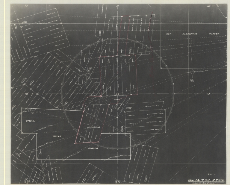
Map of Belle placer and other claims in Lake County
Alternative Title:
U.S.M.M. Big Evans
State:
Colorado
County:
Lake
USGS Quadrangle:
Climax
Type of Resource:
cartographic image
Genre:
Maps
Place Term:
[Place of publication not given]
Publisher:
[Publisher not identified]
Date Issued:
Undated
Language Term:
English
Form:
Cartographic materials
Internet Media Type:
image/tiff
Extent:
1 map ; 34.5 x 41.5 cm
Digital Origin:
reformatted digital
Mine Note:
Philip No. 1 (lode); Philip No. 2 (lode); Philip No. 3 (lode); Philip No. 4 (lode); Philip No. 5 (lode); Philip No. 6 (lode); Diamond E. (lode); Diamon D. (lode); Diamond A. (lode); Leo D. (lode); Elsie Frances (lode); Pauline (lode); Harris No. 1 (lode); Harris No. 2 (lode); Harris No. 3 (lode); Harris No. 4 (lode); Harris No. 5 (lode); Ticket Broker No. 1 (lode); Ticket Broker No. 2 (lode); Ticket Broker No. 3 (lode); Joseph S. (lode); John J. No. 1 (lode); John J. No. 2 (lode); John J. No. 3 (lode); Belle Placer; The Nettie S. Placer; Helen Frances (lode); Nina (lode); Morgan (lode); Mohwak (lode); Manhattan (lode); Mikado (lode); Don No. 1 (lode); Don No. 2 (lode); Rockfeller No. 2 (lode); Stelias (lode); Aetna (lode); Lafayette No. 1 (lode); Lafayette No. 2 (lode); Lafayette No. 3 (lode); Lafayette No. 4 (lode); 1898 No. 1 (lode); 1898 No. 2 (lode); Oro Nogo (lode); Howell (lode); Snow (lode); Superior (lode); Ulrica (lode); Philip No. 6 (lode); Augustana No. 1 (lode); Augustana No. 2 (lode); Augustana No. 3 (lode); Rogers; Gold Belt No. 1 (lode); Gold Belt No. 2 (lode); Gold Belt No. 3 (lode); Davis; Elk; Ethel; Daisy; Daisy No. 2; Kemble; Alleghany Placer
Note:
Claim map 6th 9S 79W section 14
Subject Topic:
Mines and mineral resources
Scale:
[Scale not given.]
Coordinates:
39° 16' 1.56'' N / 106° 11' 28.68'' W
Meridian:
6th
Public Land Survey Location:
Sec.14, T.9S.R.79W
Identifier:
43347500.tif
Physical Location:
Jerry Crail Johnson Earth Sciences & Map Library, University of Colorado Boulder
Rights:
The copyright and related rights status of this Item has been reviewed by the organization that has made the Item available, but the organization was unable to make a conclusive determination as to the copyright status of the Item. Please refer to the organization that has made the Item available for more information. You are free to use this Item in any way that is permitted by the copyright and related rights legislation that applies to your use.
Map of Belle placer and other claims in Lake County