COLLECTION NAME:
Mining Maps of Colorado
Record
Collection Name:
Mining Maps of Colorado
Title:
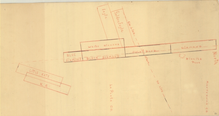
Map of mining claims near Diorite Peak
State:
Colorado
County:
La Plata
USGS Quadrangle:
La Plata
County:
Montezuma
Type of Resource:
cartographic image
Genre:
Maps
Place Term:
[Place of publication not given]
Publisher:
[Publisher not identified]
Date Created:
Undated
Language Term:
English
Form:
Cartographic materials
Internet Media Type:
image/tiff
Extent:
1 map : manuscript, colored pencil ; 25.5 x 49 cm
Digital Origin:
reformatted digital
Mine Note:
Little Kate; Blue Diamond; White Diamond; Black Diamond; Gold Band; Diamond; Eagle; Golden Eagle; K.P.
Commodity Note:
Gold
Subject Topic:
Mines and mineral resources
Subject Geographic:
Montezuma (Summit, Colorado, United States, North America) (populated place)
Subject Geographic Authority:
GNIS: 182421
Scale:
[Scale not given.]
Coordinates:
37° 25' 57'' N / 108° 3' 36'' W
Meridian:
NM
Public Land Survey Location:
Sec.27, T.37N.R.11W
Subject Geographic:
Diorite Peak (La Plata, Colorado, United States, North America) (summit)
Subject Geographic Authority:
GNIS: 178989
Identifier:
43345200.tif
Physical Location:
Jerry Crail Johnson Earth Sciences & Map Library, University of Colorado Boulder
Rights:
The copyright and related rights status of this Item has been reviewed by the organization that has made the Item available, but the organization was unable to make a conclusive determination as to the copyright status of the Item. Please refer to the organization that has made the Item available for more information. You are free to use this Item in any way that is permitted by the copyright and related rights legislation that applies to your use.
Map of mining claims near Diorite Peak