|
Name Display Form
Colorado. Office of the State Engineer
Title
Biennial report of the State Engineer of the State of Colorado for the years
Name Display Form
Denver Lith. Co.
Title
Boulder
Date Issued
After 1894
Name Display Form
Freeze, Sam'l (Samuel)
Title
Boulder Co., Colorado
Date Issued
[1881]
Title
Broadmoor
Date Issued
[between 1890 and 1902?]
Name Display Form
Boehmer, Max
Title
Bœhmer's topographical map of the carbonate regions in the vicinity of Leadville, Colorado : showing location of mines and prominent prospects from actual surveys made in October 1879
Date Issued
1879
Name Display Form
Hunter, Thomas (Lithographer)
Title
Cannon's map of the mineral belt of Colorado
Date Issued
Approximately 1882
Name Display Form
Hunter, Thomas (Lithographer)
Title
Cannon's map of the mineral belt of Colorado
Date Issued
Approximately 1882
Name Display Form
[Clason Map Co., Colorado. State Board of Immigration]
Title
Clason's guide map of Colorado
Date Issued
1917
Name Display Form
[Clason Map Co., Colorado. State Board of Immigration]
Title
Clason's guide map of Colorado
Date Issued
1917
Name Display Form
Clason Map Co.
Title
Clason's irrigation map of the Arkansas Valley, Colorado
Date Issued
[between 1911 and 1920?]
Name Display Form
Clason Map Co.
Title
Clason's Map of the San Luis Valley
Date Issued
1908
Name Display Form
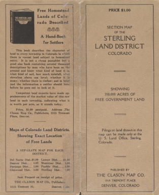
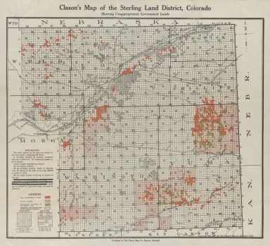
Clason Map Co.
Title
Clason's map of the Sterling Land District, Colorado
Date Issued
1916
Name Display Form
Clason Map Co.
Title
Clason's map of the Sterling Land District, Colorado
Date Issued
1916
Name Display Form
[Greeley, William B., 1879-1955, Good, L. S., compiler]
Title
Cochetopa National Forest, Colorado : New Mexico principal meridian
Name Display Form
Geological Survey (U.S.)
Title
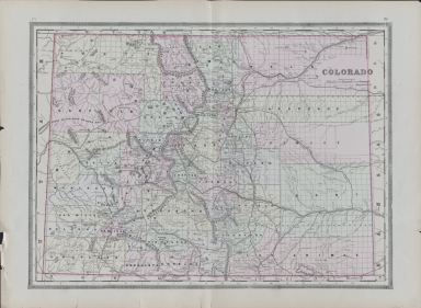
Colorado
Date Issued
[2001, 2001]
Name Display Form
Mitchell, S. Augustus (Samuel Augustus), 1792-1868
Title
Colorado
Date Issued
1878
Title
Colorado
Date Issued
Circa 1885
Title
Colorado
Date Issued
Circa 1885
Name Display Form
O.W. Gray & Son
Title
Colorado and Kansas
Date Issued
Circa 1875
Name Display Form
O.W. Gray & Son
Title
Colorado and Kansas
Date Issued
Circa 1875
Name Display Form
[Colorado. Office of the State Engineer, Colorado. Division of Water Resources. Hydrographic Branch]
Title
Colorado historical average annual stream flows (acre feet)
Date Issued
2003
Name Display Form
Chicago, Burlington & Quincy Railroad Company
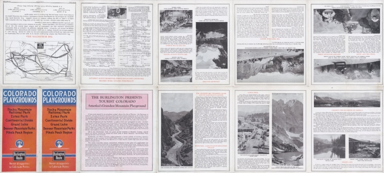
Title
Colorado playgrounds : Rocky Mountain National Park, Estes Park, Continental Divide, Grand Lake, Denver Mountain Parks, Pike's Peak region
Date Issued
1922
Name Display Form
Chicago, Burlington & Quincy Railroad Company
Title
Colorado playgrounds : Rocky Mountain National Park, Estes Park, Continental Divide, Grand Lake, Denver Mountain Parks, Pike's Peak region
Date Issued
1922
Name Display Form
Colorado. Department of Highways. Planning and Research Division
Title
Colorado, 1964
Date Issued
1964
Name Display Form
Cram, George Franklin, 1841-1928
Title
Colorado; New Mexico
Date Issued
Between 1884 and 1887
Name Display Form
Cram, George Franklin, 1841-1928
Title
Colorado; New Mexico
Date Issued
Between 1884 and 1887
Title
Denver land district
Date Issued
1887/1889
Name Display Form
Drumm, Henry A., 1857-1937
Title
Drumm's pocket map of Boulder County Colorado
Date Issued
[1904, 1906]
Name Display Form
Drumm, Henry A., 1857-1937
Title
Drumm's pocket map of Boulder County Colorado
Date Issued
[1904, 1906]
Name Display Form
Drumm, Henry A., 1857-1937
Title
Drumm's pocket map of Boulder County Colorado
Date Issued
[1904, 1905]
Name Display Form
Drumm, Henry A., 1857-1937
Title
Drumm's pocket map of Boulder County Colorado
Date Issued
[1904, 1905]
Name Display Form
Drumm, Henry A., 1857-1937
Title
Drumm's pocket map of Boulder County Colorado
Date Issued
[1904, 1914]
Title
Geologic map of the vicinity of Boulder, Colorado [tan]
Date Issued
[1900]
Title
Geologic map of the vicinity of Boulder, Colorado [white]
Date Issued
[1900]
Name Display Form
Union Pacific Railroad Company
Title
Gold and silver mining districts reached via Union Pacific Railroad : [western United States]
Date Issued
[1896 or 1897?]
Name Display Form
Union Pacific Railroad Company
Title
Gold and silver mining districts reached via Union Pacific Railroad : [western United States]
Date Issued
[1896 or 1897?]
Name Display Form
Handy, H. P.
Title
Map of Boulder County Colorado
Date Issued
1888
Name Display Form
Willits, W. C. (Warren C.), 1847-1901
Title
Map of Brown, Sherman, Republican and Leavenworth Mountains, Colorado
Date Issued
1878
Name Display Form
Kenyon Printing & Mfg Co.
Title
Map of Colorado
Date Issued
[1902, 1905]
Name Display Form
Kenyon Printing & Mfg Co.
Title
Map of Colorado
Date Issued
[1902, 1905]
Name Display Form
Kenyon Printing & Mfg Co.
Title
Map of Colorado
Date Issued
[1902, 1905]
Name Display Form
Cram, George Franklin, 1841-1928
Title
Map of Colorado
Date Issued
Between 1902 and 1908
Name Display Form
Cram, George Franklin, 1841-1928
Title
Map of Colorado
Date Issued
Between 1902 and 1908
Name Display Form
[LeRue, E. C, Geological Survey (U.S.)]
Title
Map of Colorado River and its tributaries [Southwestern States] : showing volume of discharge
Date Issued
1916
Name Display Form
[Bonsall, J. H. (Joseph H.), Kellogg, E. H.]
Title
Map of Colorado with plans of its Principal towns, compiled from official authorities
Date Issued
1872
Name Display Form
Williamson-Haffner Co.
Title
Map of Cripple Creek gold mining district
Date Issued
[1895]
Name Display Form
Reistle, Frank, 1858-1911
Title
Map of Cripple Creek Mining District
Date Issued
Between 1893 and 1899
Name Display Form
Bruné, F. F. (Francis F.)
Title
Map of Griffith District : Clear Creek Co., Colorado Ter. : showing the property owned by the Clear Creek Gold Mining Proprietors & the Wilson & Cass Gold Mining Co.
Date Issued
[between 1861 and 1867]
|


![Geologic map of the vicinity of Boulder, Colorado [tan]](https://cudl.colorado.edu/MediaManager/srvr?mediafile=/Size1/CUB~13~13/4709/maps_coHistorical_geologicVicinity1900b_d.jpg)
![Geologic map of the vicinity of Boulder, Colorado [white]](https://cudl.colorado.edu/MediaManager/srvr?mediafile=/Size1/CUB~13~13/4709/maps_coHistorical_geologicVicinity1900a_d.jpg)
![Gold and silver mining districts reached via Union Pacific Railroad : [western United States]](https://cudl.colorado.edu/MediaManager/srvr?mediafile=/Size2/CUB~13~13/4709/maps_coHistorical_1896_goldSilverViaUPRR_back_d.jpg)
![Gold and silver mining districts reached via Union Pacific Railroad : [western United States]](https://cudl.colorado.edu/MediaManager/srvr?mediafile=/Size2/CUB~13~13/4709/maps_coHistorical_1896_goldSilverViaUPRR_d.jpg)


![Map of Colorado River and its tributaries [Southwestern States] : showing volume of discharge](https://cudl.colorado.edu/MediaManager/srvr?mediafile=/Size2/CUB~13~13/4709/maps_coHistorical_1916_coRiverTributaries_d.jpg)


