|
Title
Aspen Mine Tunnel in Wyoming
Coverage (Spatial)
Wyoming (United States, North America) (first order administrative divisions)
Date
[1903]
Title
Pile of mine timbers at Charter Oak Copper Mine in Wyoming
Coverage (Spatial)
[Southern Wyoming (Wyoming, United States, North America) (area), Encampment (Carbon, Wyoming, United States, North America) (populated place)]
Date
1906
Title
Shaft house at Charter Oak Copper Mine at Wyoming
Coverage (Spatial)
[Southern Wyoming (Wyoming, United States, North America) (area), Encampment (Carbon, Wyoming, United States, North America) (populated place)]
Date
1906
Creator
Dale, Matthew H.
Date
1861-03-12
Coverage
[Nevadaville (Colo.), Rocky Mountains, Colorado Territory]
Subcollection
Matthew H. Dale Collection
Creator
Dale, Matthew H.
Date
1860-03-18
Coverage
[Kansas Territory, Nevadaville (Colo.), Rocky Mountains]
Subcollection
Matthew H. Dale Collection
Creator
Dale, Matthew H.
Date
1859-05-25
Coverage
[Kansas Territory, Council Grove (Kan.)]
Subcollection
Matthew H. Dale Collection
Creator
Dale, Matthew H.
Date
1859-04-27
Coverage
[Fort Leavenworth (Kan.), Kansas Territory]
Subcollection
Matthew H. Dale Collection
Creator
Dale, Matthew H.
Date
1859-08-16
Coverage
[Kansas Territory, Arapahoe County (Colo.)]
Subcollection
Matthew H. Dale Collection
Creator
Dale, Matthew H.
Date
1859-11-27
Coverage
[Kansas Territory, Nevadaville (Colo.), Rocky Mountains]
Subcollection
Matthew H. Dale Collection
Creator
Dale, Matthew H.
Date
1859-12-26
Coverage
[Kansas Territory, Nevadaville (Colo.), Rocky Mountains]
Subcollection
Matthew H. Dale Collection
Creator
Dale, Matthew H.
Date
1859-08-20
Coverage
[Kansas Territory, Arapahoe County (Colo.)]
Subcollection
Matthew H. Dale Collection
Creator
Dale, Matthew H.
Date
1860-08-31
Coverage
[Kansas Territory, Rocky Mountains, Nevada Gulch (Gilpin, Colorado, United States, North America) (valley)]
Subcollection
Matthew H. Dale Collection
Creator
Dale, Matthew H.
Date
1860-01-22
Coverage
[Kansas Territory, Nevadaville (Colo.), Rocky Mountains]
Subcollection
Matthew H. Dale Collection
Creator
Dale, Matthew H.
Date
1861-06-30
Coverage
[Nevadaville (Colo.), Rocky Mountains, Colorado Territory]
Subcollection
Matthew H. Dale Collection
Title
Ghost Towns of Pikes Peak
Date Created
1952
Identifier
U183049111296_narv_cuExtension_ghostTownsPikesPeak_a.mp4
Title
Ghost towns of the Rockies
Date Created
1951
Identifier
U183049111301_narv_cuExtension_ghostTownsRockies_a.mp4
Title
Workings of the Chloride-Bailey Mine
Date Issued
Undated
County
Trinity
Identifier
mesc_miningMaps_43355704.tif
Title
Workings of Richmond & Fairfax Mines
County
Boulder
Identifier
mesc_miningMaps_43320300.jpg
Title
Veteran, Enterprise and Murphy mines
County
Pitkin
Identifier
mesc_miningMaps_43370200.tif
Title
Union and Griffith Mining Districts
Date Issued
1882
County
Clear Creek
Identifier
mesc_miningMaps_43367500.tif
Title
Underground workings, Hibschle Shaft
Date Issued
1957
County
Lake
Identifier
mesc_miningMaps_43366300.tif
Title
Underground workings, Hibschle Shaft
Date Issued
1957
County
Lake
Identifier
mesc_miningMaps_43366400.tif
Title
Underground workings of the Concord Tunnel
Date Issued
1928
County
Teller
Identifier
43375100.tif
Title
U.S.M.M's Adams, Lead, and Dewey
Date Issued
Undated
County
Grand
Identifier
mesc_miningMaps_43370500.tif
Title
U.S.L.M Comstock Lode
Date Issued
Undated
County
La Plata
Identifier
43357700.tif
Title
U.S.L.M Comstock Lode
Date Issued
Undated
County
La Plata
Identifier
43357800.tif
Title
Township No. 37 south, range No. 17 west of the New Mexico principal meridian, Colorado
Date Issued
Undated
County
Montezuma
Identifier
mesc_miningMaps_NM37n17w Pulic Lands and Minerals.tif
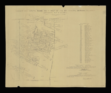
Title
Township no. 1 south, range no. 71 west of the 6th principal meridian, Colorado
Date Issued
1930
County
Boulder
Identifier
mesc_miningMaps_43321500.jpg
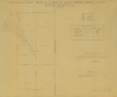
Title
Township No. 1 south, range No. 71 west of the 6th principal meridian, Colorado
Date Issued
1930
County
Boulder
Identifier
mesc_miningMaps_43357400.tif
Title
Township No. 1 south, range No. 71 west of the 6th principal meridian, Colorado
Date Issued
1930
County
Boulder
Identifier
43355100.tif
Title
Township No. 1 south, range No. 59 west of the 6th principal meridian, Colorado
Date Issued
Undated
County
Adams
Identifier
6th1s59w Public Lands and Minerals.tif
Title
Town map of Colorado Springs
Date Issued
1889
County
El Paso
Identifier
43345400.tif
Title
Topographical map showing the metal mines of Summit County, Colorado
Date Issued
Undated
County
Summit
Identifier
mesc_miningMaps_43367200.tif
Title
Topographic map of a section of Ouray County, Colorado
Date Issued
Undated
County
Ouray
Identifier
mesc_miningMaps_43350300.tif
Title
Titles of mines in Victor, Colorado
Date Issued
1898
County
Teller
Identifier
43370300.tif
Title
Tin Cup Mining District
Date Issued
1882
County
Gunnison
Identifier
mesc_miningMaps_43367400.tif
Title
The Leadville Mining District
Date Issued
1901
County
Lake
Identifier
mesc_miningMaps_43366800.tif
Title
The King Gold Mining Company's mine claims
Date Issued
[1900]
County
Teller
Identifier
43371500.tif
Title
The King Gold Mining Company's mine claims
Date Issued
[1900]
County
Teller
Identifier
mesc_miningMaps_43371700.tif
Title
The Goodwill Tunnel
Date Issued
Undated
County
Teller
Identifier
43378400.tif
Title
The Dome Lode mining claim
Date Issued
1900
County
Summit
Identifier
43356800.tif
Title
Tenderfoot Shaft
Date Issued
1944
County
Boulder
Identifier
43377900.tif
Title
Survey No. 19873 Pueblo Land District
Date Issued
1896
County
Teller
Identifier
43359600.tif
Title
Survey No. 10906 Pueblo Land District
Date Issued
[1896]
County
Teller
Identifier
43356900.tif
Title
Survey No. 10810 Pueblo Land District
Date Issued
1896
County
Teller
Identifier
43354500.tif
Title
Sunday Mine
Date Issued
[1941]
County
San Miguel
Identifier
43347000.tif
Title
Sugar Loaf Mining District
Date Issued
Undated
County
Boulder
Identifier
mesc_miningMaps_43321400.jpg
Title
Stoping map
Date Issued
Undated
County
Teller
Identifier
mesc_miningMaps_43353900.tif
Title
Star Mine
Date Issued
1943
County
Boulder
Identifier
43377601.tif
|