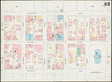
Detail View: Sanborn Fire Insurance Maps of Colorado: Insurance maps of Denver, Colorado. Volume two

|
File Name:
|
den90053.tif
|
|
Sheet:
|
v.2, sh. 53
|
|
Author:
|
Sanborn-Perris Map Co
|
|
Title:
|
Insurance maps of Denver, Colorado. Volume two
|
|
Other Title:
|
Sanborn fire insurance maps. Colorado
|
|
Other Title:
|
Denver, Colorado
|
|
Date:
|
1890
|
|
Publication Info:
|
New York : Sanborn-Perris Map Co., 1890
|
|
Description:
|
1 map on 43 sheets : col. ; sheets 68 x 92 cm., folded in half and bound
|
|
Scale:
|
Scale [ca. 1:600] 50 ft. to an inch
|
|
City:
|
Denver
|
|
County:
|
Denver County
|
|
Subject:
|
Insurance, Fire -- Colorado -- Denver -- Maps
|
|
Note:
|
Shows building construction by hand coloring, locations of windows and doors, and available water facilities
|
|
Note:
|
Shows factories, commercial and religious occupancy of buildings, dwellings with property boundaries and house and block numbers
|
|
Note:
|
Sheets are numbered 52-93; title page, key map, and index to sheets are on two unnumbered sheets
|
|
Note:
|
1890
|
|
Note:
|
Historical maps of neighborhoods, detailed at the block and building level, showing residential, commercial, and industrial uses of site, building footprints, potential environmental hazards, and construction details of structures
|
|
Note:
|
Includes notes on population, water facilities, fire department, and prevailing winds
|
|
Note:
|
Microfilm edition known as: Sanborn fire insurance maps. Colorado
|
|
Funding Info:
|
This project was funded in part through a Library Services and Technology Act (LSTA) grant administered by the Colorado State Library and in part by the Friends of the Libraries
|
|
Conditions of Use:
|
Rights: https://rightsstatements.org/page/NoC-NC/1.0/?language=en
|
|
Physical Item Location:
|
Bibliographic number: b4036097
|
|
Holding Institution:
|
Map Library, University Libraries, University of Colorado at Boulder
|
|
Identifier ARK:
|
https://ark.colorado.edu/ark:/47540/6t4p94174135
|