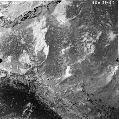
Detail View: Aerial Photographs of Colorado: BOW 28-25
|
County Set Name:
|
Larimer / Grand
|
|
Project-Roll-Frame:
|
BOW 28-25
|
|
Date:
|
1946-09-10
|
|
Publisher:
|
United States Forest Service
|
|
Scale:
|
1:20,000
|
|
County:
|
Boulder
|
|
State:
|
Colorado
|
|
1:24000 USGS Topo Quad Name:
|
Monarch Lake
|
|
Landmark:
|
Fourth of July Mine
|
|
Center Point Latitude:
|
40° 00' 27" N
|
|
Center Point Longitude:
|
105° 37' 51" W
|
|
Type:
|
Still image
|
|
Internet Media Type:
|
image/jpg
|
|
Format:
|
aerial photographs
|
|
Format:
|
black-and-white photographs
|
|
Physical Item Location:
|
Map Collection page: https://www.colorado.edu/libraries/libraries/earth-sciences-map-library/map-library-collection
|
|
Rights:
|
The organization that has made the Item available believes that the Item is in the Public Domain under the laws of the United States, but a determination was not made as to its copyright status under the copyright laws of other countries. The Item may not be in the Public Domain under the laws of other countries. Please refer to the organization that has made the Item available for more information. URI: http://rightsstatements.org/vocab/NoC-US/1.0/
|
|
Identifier:
|
BOW028025.jpg
|
|
Identifier ARK:
|
https://ark.colorado.edu/ark:/47540/qj9w2698b27f
|