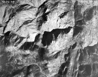
Detail View: Aerial Photographs of Colorado: BOW 18-36
|
Project-Roll-Frame:
|
BOW 18-36
|
|
Date:
|
1938-10-26
|
|
Publisher:
|
United States Forest Service
|
|
Scale:
|
1:20,000
|
|
County:
|
Boulder
|
|
State:
|
Colorado
|
|
1:24000 USGS Topo Quad Name:
|
Raymond
|
|
Landmark:
|
South Sheep Mountain
|
|
Center Point Latitude:
|
40 12 38
|
|
Center Point Longitude:
|
-105 25 50
|
|
Physical Item Location:
|
For more information about the physical collection visit the Jerry Crail Johnson Earth Sciences & Map Library.
|
|
Rights:
|
The organization that has made the Item available believes that the Item is in the Public Domain under the laws of the United States, but a determination was not made as to its copyright status under the copyright laws of other countries. The Item may not be in the Public Domain under the laws of other countries. Please refer to the organization that has made the Item available for more information. URI: http://rightsstatements.org/vocab/NoC-US/1.0/
|
|
Identifier ARK:
|
https://ark.colorado.edu/ark:/47540/qj9k283936sx
|