Detail View: Archivision Base to Module 9: Los Angeles: Aerial (from Airplane) Topographic Views
|
Preferred Title:
|
Los Angeles: Aerial (from Airplane) Topographic Views
|
|
Image View:
|
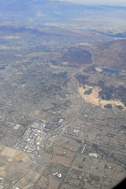
Irvine area
|
|
Creator:
|
Scott Gilchrist (Canadian photographer, born 1960)
|
|
Location:
|
creation: Los Angeles, California, United States
|
|
Location Note:
|
Los Angeles Basin
|
|
GPS:
|
+34.05-118.25
|
|
Date:
|
August 2007 (creation)
|
|
Cultural Context:
|
American
|
|
Style Period:
|
Twenty-first century
|
|
Work Type 1:
|
topographical view
|
|
Work Type 2:
|
photograph
|
|
Classification:
|
urban and topographical views
|
|
Material:
|
digital images
|
|
Technique:
|
photography
|
|
Description:
|
The Los Angeles Basin is the coastal sediment-filled plain located between the Peninsular and Transverse ranges in southern California in the United States containing the central part of the city of Los Angeles as well as its southern and southeastern suburbs (both in Los Angeles and Orange counties). It is approximately 35 miles (56 km) long and 15 miles (24 km) wide, bounded on the north by the Santa Monica Mountains and Puente Hills, and on the east and south by the Santa Ana Mountains and San Joaquin Hills. The Palos Verdes Peninsula, formerly an island, marks the outer edge of the basin along the coast. The confluence of the Los Angeles and Rio Hondo rivers is the center of the basin. (Source: Wikipedia; http://en.wikipedia.org/wiki/Main_Page)
|
|
Collection:
|
Archivision Addition Module Eight
|
|
Identifier:
|
1A2-US-LA-TVAP-A44
|
|
Rights:
|
© Scott Gilchrist, Archivision, Inc.
|